Archaeology
The Binsted earthwork, and the Binsted/Arundel 'oppidum'
A prehistoric earthwork (ditch and bank) runs north-south through Binsted, and north of the A27 as far as Madehurst on the Downs. It is probably related to the ‘Chichester entrenchments’, an enigmatic system of Iron Age fortifications centred on Chichester; there are few such systems in the country. These systems, now known as ‘territorial oppida’, may have been for defence, or to mark possession of a territory.
The Binsted/Arundel area 'oppidum' as identified by David McOmish goes from Binsted's Marsh Farm wetlands all the way up to Whiteways Lodge and down to the Arun from there, enclosing the oppidum between the earthwork and the Arun. The Binsted earthwork is visible in the fields north and south of Binsted church, and also in Hundred House Copse. Parts are designated an Ancient Monument.
Bells of Binsted
North of Binsted church, a ‘bell pit’, where a bell was cast, has been excavated by archaeologists. This was originally dug in the soft material which had partly filled the ditch of the historic earthwork.

Binsted's medieval pottery and tile manufacture
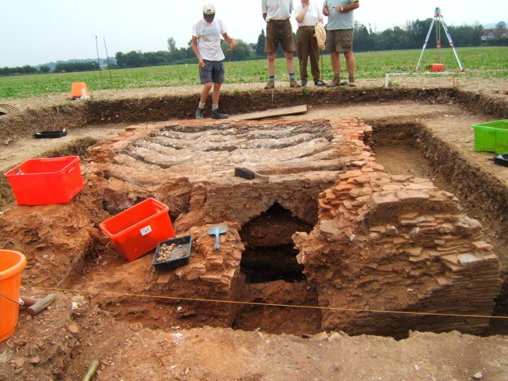
Two mediaeval tile kilns have been excavated in Binsted – one in the 1960s and another in 2005-6. ‘Binsted ware’ pottery included jugs with faces on the handles. The area near the Black Horse Pub, where Hedgers Hill joins Binsted Lane, was known as ‘All the World’ – being between the two tile kilns it must have been very busy.
The field east of the Black Horse pub is full of history – it contains part of the earthwork and one of the buried tile kilns, and is bordered by Margary's Roman road...
Binsted's Roman Road
Ivan Margary’s conjectured Roman road from the 1940s – on the route of the track known as Scotland Lane – also passes through ‘All the World’, and a Roman Villa has recently been excavated over several years on the opposite bank of the Binsted rife. The recent LiDAR survey has found traces of the Roman Road running just south of the A27, not far from Margary's conjectural route.
Binsted Hundred
The likely site of the medieval open air meeting place for the Binsted Hundred has recently been identified, on the north side of the B&B at 'All the World', being a large domed rise with a hollow way leading up to it from the wooded valley of Hundred House Copse.


